Loading preview…
Geospatial Intelligence Desk
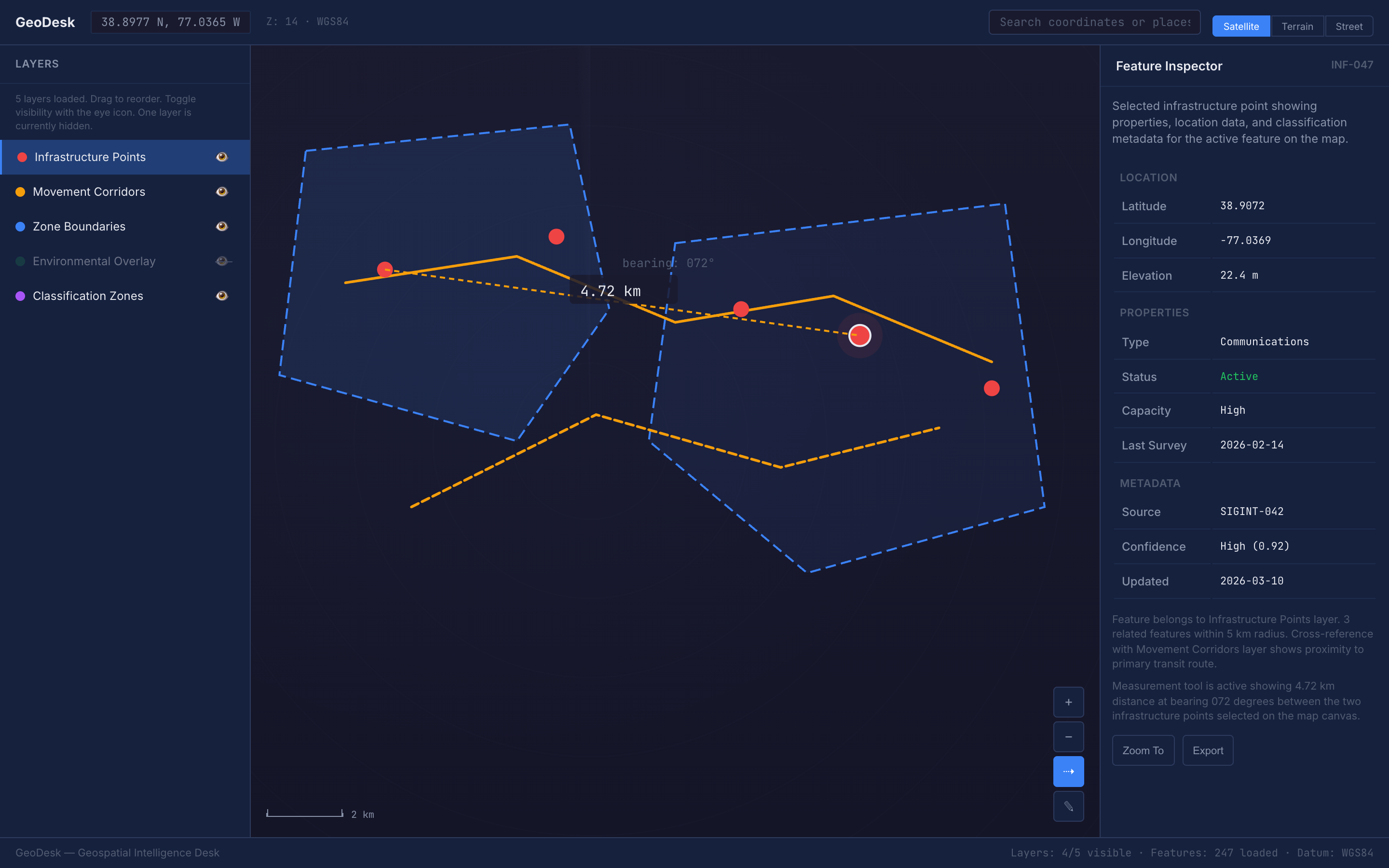
A cartographic-precision dark map analysis workspace with layer management, measurement tools, coordinate readouts, and feature inspection panels for intelligence and geospatial data analysis.
Apply this design skill
Read the SKILL.md at https://joincommons.cc/api/items/geospatial-intelligence-desk and apply its design language to my project
Designed by humans. Applied by agents.
Design Language
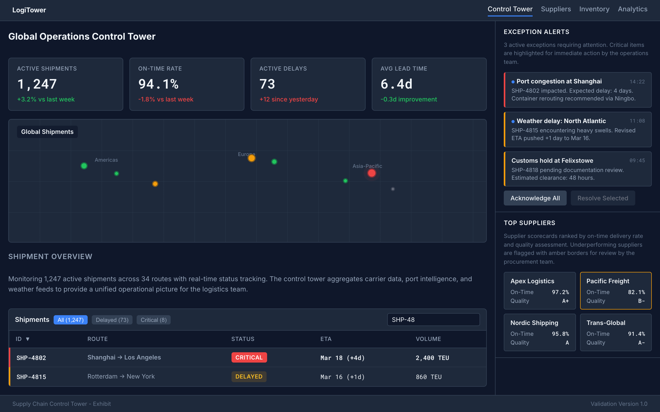
A dark-themed, military-grade geospatial analysis workspace featuring layer stack management, precision measurement tools, coordinate search, satellite/terrain toggles, and feature inspector panels, all built on cartographic visual language with topographic contour motifs and a strict primary/secondary/tertiary information hierarchy.
Agent instructions (SKILL.md)(advanced)
Design Skill
This Design Skill provides a comprehensive dark-themed geospatial analysis workspace language. It establishes cartographic precision with military-grade information hierarchy, layer stack management, coordinate readouts in monospace, measurement overlays, and feature inspector panels, all rendered on a dark navy map canvas that maximizes data overlay visibility.